Kettletown State Park
Appearance
| Kettletown State Park | |
|---|---|
 Lake Zoar | |
| Location | Oxford and Southbury, Connecticut, United States |
| Coordinates | 41°25′29″N 73°12′22″W / 41.42472°N 73.20611°W[1] |
| Area | 605 acres (245 ha)[2] |
| Elevation | 98 ft (30 m)[1] |
| Established | 1950[3] |
| Administered by | Connecticut Department of Energy and Environmental Protection |
| Designation | Connecticut state park |
| Website | Official website |
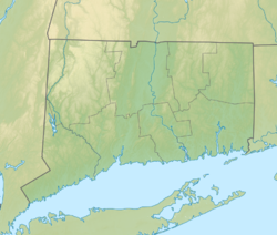
Kettletown State Park is a public recreation area on the eastern shore of the Housatonic River's Lake Zoar in the towns of Oxford and Southbury, Connecticut. Park activities include camping, hiking, picnicking, and fishing. The state park is managed by the Connecticut Department of Energy and Environmental Protection.[2]
References
[edit]- ^ a b "Kettletown Brook". Geographic Names Information System. United States Geological Survey, United States Department of the Interior.
- ^ a b "Kettletown State Park". Connecticut Department of Energy and Environmental Protection. Retrieved August 18, 2024.
- ^ "Kettletown State Park". Connecticut Department of Energy and Environmental Protection. Archived from the original on March 3, 2016. Retrieved October 25, 2017.
External links
[edit]Wikimedia Commons has media related to Kettletown State Park.
- Kettletown State Park Connecticut Department of Energy and Environmental Protection
- Kettletown State Park Map Connecticut Department of Energy and Environmental Protection


